|
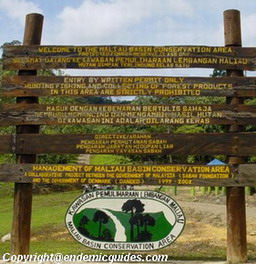
Welcome To
MALIAU BASIN
CONSERVATION AREA
PAGE
|
Introduction & History
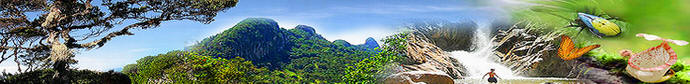
It is like a big basin with a mile of lush green forest
inside. On top of Maliau Basin, it’s a montane
forest with cool weather.
The 588.4 km² Maliau Basin Conservation Area, encompasses
the whole of Maliau Basin itself (390 km²), plus an
additional 198.4 km² of forested land to the east
and north of the rim, including the fabled Lake
Linumunsut (Sabah’s only true lake), formed by a
landslide blocking a small tributary of the Pinangah
River.
While this entire region is rugged, the saucer-shaped Maliau
Basin is distinguished by its almost circular
perimeter, sharply delimited on all sides by cliffs
or very steep slopes, making it insurmountable on
foot from most directions. The highest point is on
the north rim, at over 1,675 m in elevation, but has
yet to be accurately surveyed. Resembling a volcanic
caldera, the 25 km diameter Basin is in fact a
sedimentary formation comprised mainly of gently
inclined beds of sandstone and mudstone.
The 390 km2 Maliau Basin was originally part of a 10,000 km2
timber concession belonging to Yayasan Sabah (the
Sabah Foundation), an organization formed in 1966
through an Enactment by the State Legislative
Assembly, with the objective of improving the
standard of living and education of Malaysians in
Sabah. In 1981 Yayasan Sabah voluntarily designated
Maliau Basin as a Conservation Area for the purposes
of research, education and training, along with
Danum Valley Conservation Area further to the east.
This entire region is rugged, saucer-shaped Maliau Basin is
distinguished by its almost circular perimeter,
sharply delimited on all sides by cliffs or very
steep slopes up to 1,500m in height, thus making it
insurmountable on foot from most directions. The
highest point is thought to be Gunung Lotung on the
north rim, which is over 1,600 m in elevation, but
has yet to be accurately surveyed. Resembling a
volcanic caldera, the 25 km diameter Basin is in
fact a sedimentary formation comprised mainly of
gently inclined beds of sandstone and mudstone.

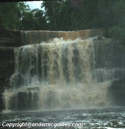
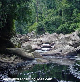
The Basin represents a single catchment, and is drained by a
set of radiating tributaries of the Maliau River,
one of which descends a magnificent series of
waterfalls, known as Maliau Falls. Numerous smaller
waterfalls have also been discovered throughout the
Basin. The Maliau River then drains through a gorge
out of the southeast of the Basin into the Kuamut
River, which in turn feeds into the Kinabatangan,
the longest river in Sabah. The water here is tea-coloured
and acidic, due to the tannins leaching out of the
peaty leaf litter. The stunted montane heath forest
occurs on flatter areas of the Basin on nutrient
poor acidic soils.
The basin was 'officially discovered' in 1947, by a pilot.
But it was not until 1988 that the first major
scientific expedition organised by Yayasan Sabah and
WWF Malaysia took place. However, international
pressure became increasingly strong to preserve the
world-unique area. In 1997 the Maliau Basin
Conservation Area was upgraded by the Sabah state
government to a Protection (Class One) Forest
Reserve.
A four-year project was initiated by Yayasan Sabah in 1999
collaboration with DANIDA (Danish International
Development Assistance) to prepare a management plan
for the area and to establish a new facility, the
Maliau Basin Studies Centre, at the southeast edge
of the Basin, for conservation, research, education
and ecotourism purposes.
In 2000 intensive field surveys started as part of the
preparation of the Maliau Basin Conservation Area
Management Plan. The objective of the project was to
secure the conservation of Maliau Basin for the
benefit of Sabah, Malaysia and the international
community.
The first major expedition to Lake Linumunsut in the
northern part of Maliau was conducted in 2001. By
now, only about 25% of the total area has been
mapped, and less than 10% have been studied
intensively. Yet, the Basin has already yielded more
new species of plants and animals than many other
places over many more years of studies.
In 2002 we celebrated the ground breaking for the Maliau
Basin Studies Centre Site by HRH Prince Henrik of
Denmark and Tan Sri Datu Khalil bin Datu Haji
Jamalul, the Director of Yayasan Sabah.
The Murut, who traditionally inhabit the area but have never
settled in the forbidding basin have since time
immemorial organised a yearly hunting expedition to
the rich grounds of Maliau, and knows of the
seven-tiers waterfall, the Maliau Falls that forms
its heart – but they also know of many more stories
and legends that surround the place.
Continue Page 2 >>
|