|
Welcome To
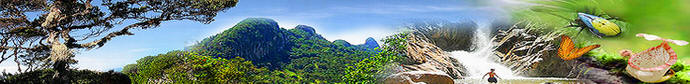
KINABATANGAN
FLOODPLAIN
PAGE-SUKAU
|
Introduction and history
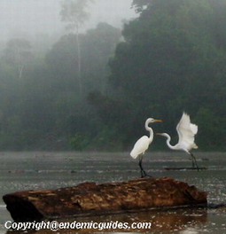
Kinabatangan is one of the most exceptional areas, but was
long threatened by logging and land clearance. Influenced
by the Sulu Sea and the rainfall of the interior, the lower
part of the river plain floods regularly, thus at least five
distinct habitats have developed contributing towards one of
the most diverse concentrations of wildlife in Borneo.
Today, people are recognizing the value of the lower
Kinabatangan, for its natural beauty and its role in
supporting nature diverse life.
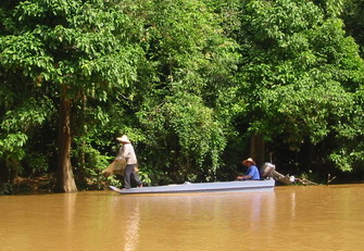
The Kinabatangan River is one of Borneo’s longest and most
majestic rivers, originating in south west of Sabah, it
flows for 560 kilometers (347 miles) through eastern Sabah
to the Sulu Sea on the east coast. The banks of the
Kinabatangan River are predominantly covered with river vine
forest.
Elephant grass grows in some areas and other areas that are
covered by short grass were deforested by illegal logging
operators. Besides the Kinabatangan River, the Menaggul
River banks support a mixture of riverrine forest and fresh
water swamp forest. This river is narrow and frequently
blocked to boat traffic by fallen trees. At times the
branches from trees on each bank intermingle high above the
river. Finally, the Tenegang Besar River is approximately
double the width of the Menanggul River. The lower portion
of this river supports a mixture of riverine and freshwater
swamp forest.

The equatorial climate is generally wet and humid and
temperature range from 23°C to 32°C all year round. Rains
are heaviest during the northeast monsoon between October
and March. The river is generally 1 M above sea level but
during heavy rain, it can rise as high as 12 M above sea
level.

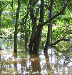
The forest covers alluvial flood with low sandstone and
limestone hills. In addition, there are fresh water swamp
forests and lakes as well as Ox-bow lakes. This lake
supports a mixture of mainly secondary riverine forest and
freshwater swamp forest. A narrow channel connects the
Kinabatangan River to the Kelenanap Ox-bow Lake. It is also
a source of fish for the local people. There are large areas
of open water as well as many raft hyacinths, Eichhornia
crassipes (exotic colonizing weeds that are unnaturally
accelerating succession leading to the demise of the lake)
in the lake.
The region
is also home to saltwater mangrove forest, river vine
forest, and dipterocarp forest. This region of the
Kinabatangan has been prized by the scientists as a natural
heritage site of international importance.
Continue Page 2 >>
|