|
Welcome To
CROCKER RANGE
PARK PAGE - SABAH
|
Introduction
and history
The Crocker
Range National Park (CRNP) is situated in the Crocker Range,
Sabah. Crocker Range was designated to be a forest reserve in
1968. CRNP was then established in 1984 to protect the water
catchments area that is supplying clean drinking water to the
West Coast and the interior of Sabah. It was then renamed to
Taman Banjaran Crocker (Crocker Range Park) in 1996 and managed
by the Sabah Parks. Additionally the rising concern to protect its rich
biodiversity and rare species of flora and fauna inhabiting
these forest areas had been the prime mover in the initiative to
gazette it as a National Park. The Park is surrounded by
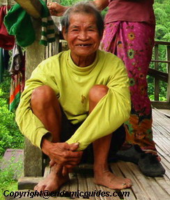
numerous settlements of the Kadazandusun and Murut communities
harbouring moderately fast growing population practicing mainly
shifting agriculture.
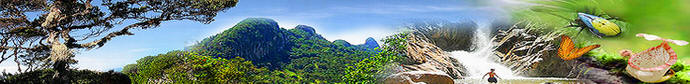
The CRNP is situated in the world’s third largest island,
Borneo, in the state of Sabah of Malaysia. The Crocker Range
divides the western coastal plains from the rest of Sabah on the
south of the great Mount Kinabalu (the tallest mountain in
Malaysia). Lying more than 300 metres above sea level, it
spreads over 139,919 hectares of densely forested terrain. The
spine of Sabah is the nickname given to the Crocker Range. Lying
north-east and South-we sternly, this range divides Sabah into
two, the western and interior eastern parks. It stretches from
south of Kundasang in the north to Tenom in the south.
Located in the park is the Padas River, which bisects the
range between Beaufort and Tenom on its journey southwest. It is
impassable to boats due to the boulders strewn along the swift
flowing Padas Gorge hence making this place the best white water
rafting sport in Island of Borneo. However, human ingenuity led
to the construction of a railway alongside the scenic gorge.
Roads crossing the range have also made the interior more
accessible from the coastal areas making it possible for
visitors to enjoy the serene tranquility in the rugged
mountains.
CRNP receives a rainfall of 3,000-4,000 mm per year, making
it one of the highest precipitation areas in Sabah. The water
catchments in the park provides an indispensable water source
for drinking, agriculture and industrial purposes, and to
sustain the daily needs of more than one third of the population
of Sabah.
The ecological significance of Borneo is recognize and
listed in ‘Global 200’ by WWF, ‘Endemic Bird Area’ by Birdlife
International, and ‘Hotspots’ by Conservation International.
Borneo is viewed as one of earth’s mega-biodiversity areas.
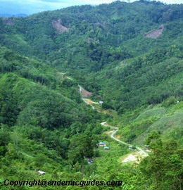
At present, Sabah Parks’ estimates more than 500 people live
within CRP’s boundaries and over 3,000ha of land are still used
for agriculture. The communities or scattered households inside
and along the park’s boundaries, whether they moved in before or
after the gazatting of the park, are relatively poorer and have
less access to the commercial and social services available in
most rural communities in the plain area. The CRNP faces many
treats including shifting cultivation, uncontrolled hunting, the
introduction of exotic fisher, and forest fires. The management
of CRNP cannot be easily improved via the existing approaches or
by simply applying the laws listed in the park Enactment. The
law itself doest not allow any residence or human activities
inside a park except those authorized by Sabah Parks.

CRNP has had very few visitors, because of the absence of
spectacular scenery as in Kinabalu Park and the possibility of
easily spotting large animals as in the Kinabatangan Wildlife
Sanctuary. CRNP’s beauty, importance and its contribution to the
public have not been well appreciated. Its conservation has not
been promoted, and fundraising for its management to a
sustainable level is limited. As a result, the development of
facilities for educational and outdoor recreation remains
insufficient.
Continue Page 2 >>
|