|
Welcome To
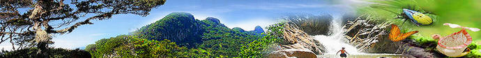
PENANG NP
PAGE - PENINSULA MALAYSIA
|
Continue From PAGE 1>>
Tanjung Aling
Follow the coastal trail via Sungai Tukun with trail
1A-1B-1C; it will take about 30 minutes to reach Tanjung Aling
from Teluk Bahang.
Tanjung Aling houses the USM research centre and the forest
and coastal areas are being used for research on bio-technology.
There is a jetty to bring in supplies from town. The beach is
easily accessible and it is a suitable camping site for campers.
It is also a resting place for visitors enroute to Muka Head (Teluk
Duyung).
Teluk Duyung (Muka
Head)
You can walk
or take a boat (only during high tide) to Teluk Duyung. You can
reach Teluk Duyung about one and half hours from Teluk Bahang by
using trail 1A-1B-1C-1D. Teluk Duyung is a beautiful bay
protected by the Muka Head's cape.
On Head's peak stands a majestic lighthouse built in 1883. A
burial ground of at least 80 years resembles that of Indonesian
Acheh and is an interesting historical artifact. The lighthouse
peak offers a panoramic view of the surrounding islands.
Teluk Ketapang
A small isolated beach originally known as Monkey Beach.
“Teluk Ketapang” is derived from the numerous sea almond trees
known locally as Pokok Ketapang. This isolated beach can be
easily accessed by boat from Teluk Bahang jetty; alternatively
you can try trail 1A-1B-1C-1D-2.
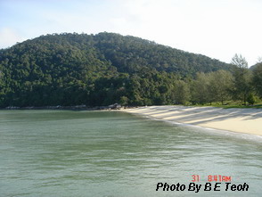
Pantai Kerachut
The meromictic lake is the greatest attraction here. It is a
popular picnic and camping site and famous turtle hatchery.
Pantai Kerachut is the only beach where the Green Sea Turtle
“Chelonia mydas” can be spotted. It is believed that the Green
Turtle only migrates here for nesting.
From End of
the World, follow the track along the coast until you cross a
suspension bridge. Take the path on the left that leads away
from the coast, or just use1A-6A-6B-6C/6D/6E. You should be able
to reach Pantai Keracut in one hour and a half.
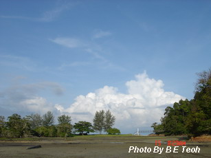
Teluk Kampi
Teluk Kampi has the longest beach in the park. There are
many artifacts and past history. The tell-tale signs of trenches
found along the northern coast indicates a defense post for the
Japanese Army during World War 2. Teluk Kampi is another
isolated beach that guarantees an easy and relaxing trip.
The most common trail is the one from Pantai Kerachut over
Tanjung Kerachut and down to Teluk Kampi using trail
1A-6A-6B-6D-6E-8A-8B-8C.

Pantai Mas
Pantai Mas is a golden beach. Formally a coconut plantation,
it is now an overgrown wasteland. Being very close to
civilization, mud and mangroves create a wilderness few people
would like to go to. The difficulty in accessing Pantai Mas by
sea could be the reason why dwellers abandoned their homes here.
Accessing Pantai Mas with fishing boats is only available
during high tides. Alternative access is through the trails from
United Hokkien Cemetery or the longer ridge trail starting from
Teluk Bahang. The easier walking trail will be from Pantai Acheh
village. It will take about 45 minutes, trail indication is
15A-15B-15C.
Bukit Telaga
Batu
The highest point is Batu Itam at 1500 feet on the southern
flank of the Park. Bukit Telaga Batu is about 1100 feet.
Getting there
and away
From Georgetown, use the northern coastal road passing
through Tanjung Tokong, Tanjung Bungah at Batu Fringghi and
Teluk Bahang town. You can start the entire major National Park
trail system from Teluk Bahang.
Enquiry Tour and Guide here >>
|